How the RVers Who Never Pay for a Campsite Actually Find Their Spots
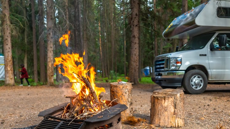
You've probably seen it before — an RV parked somewhere stunning, a canyon view or a desert wash or a hillside with nothing else in sight, no campground sign, no hookups, no neighbors. And if you've ever thought, "How do they even find that?" — this article is for you.
The RVers who never pay for a campsite aren't doing something secret or complicated. They've just learned a set of rules and tools that most people never bother to look up. Once you understand the framework, you'll start seeing free camping opportunities everywhere. The learning curve is real, but it's short.
Here's how it actually works.
What Boondocking Is (and What It Isn't)
Boondocking — also called dispersed camping or dry camping — means camping without hookups, outside of a developed campground. No water connection, no shore power, no sewer. Just you, your rig, and whatever you brought.
This is different from staying at a free or cheap developed campground. Those have designated sites and sometimes facilities. Boondocking usually means pulling off onto open land and setting up wherever the terrain and rules allow.
The appeal is obvious: no nightly fees, room to breathe, and views that no $85 campsite can compete with. The tradeoff is that you have to be genuinely self-sufficient — which is more manageable than it sounds. If you want a deeper look at what boondocking without hookups actually involves day-to-day, this guide covers the full picture. The starting point for most boondockers is Bureau of Land Management land, and for good reason.
BLM Land: The Foundation of Free Camping in America
The Bureau of Land Management administers hundreds of millions of acres of public land across the western United States, and most of it is open to dispersed camping at no charge, no reservation required. This is the single largest source of free RV camping in the country, and it's genuinely accessible — you don't need a special permit, a membership, or any particular rig to use it.
BLM land is concentrated in twelve western states: Alaska, Arizona, California, Colorado, Idaho, Montana, Nevada, New Mexico, Oregon, Utah, Washington, and Wyoming. If you're based in the East, this may feel out of reach — but for most road trips heading west, BLM land becomes an almost constant companion.
The basic rules are straightforward.
The 14-day limit. Dispersed camping on BLM land is generally limited to 14 days within any 28-day period. After that, you need to move — and the standard is at least 25 miles from your original spot before you can start a new 14-day clock. This prevents anyone from permanently occupying public land, and it's enforced in popular areas. The full framework is sometimes called the 14/28/25 rule, and it's the foundation of how most boondockers plan their movement.
Rules vary by field office. This is the part that trips people up. While the 14-day framework is federal, each BLM state office and field office can set its own specific limits, fire restrictions, and closure areas. What applies near Moab in Utah is not necessarily what applies in the Sonoran Desert in Arizona. Always verify current rules with the managing field office or on BLM.gov before a trip.
Where camping is and isn't allowed. Most open BLM land allows dispersed camping unless it's posted as closed or has specific conservation restrictions. Designated Wilderness Areas are off-limits to vehicles — no RV access. National Monuments and Conservation Areas managed by BLM generally allow dispersed camping but may have their own permit requirements or designated-site rules. Check before you go. If national parks are on your route, our breakdown of the best RV-accessible parks in the West is worth bookmarking alongside your BLM maps.
The core conduct rules. Camp at least 200 feet from any water source. Stay on designated roads — driving off-road on BLM land is not permitted unless the area is specifically designated for OHV use. Pack out everything you bring in. Check current fire restrictions before you assume a campfire is allowed; during summer and fall across much of the West, they often aren't, and fire-related citations carry serious consequences. If you're heading out for the first time, running through our RV setup checklist before you leave a service area is a smart habit — a lot of the common arrival mistakes happen when people skip that step.
A State-by-State Snapshot
Rules vary enough across regions that it's worth knowing the landscape before you head somewhere specific. All of the following states follow the federal 14/28/25 framework as a baseline, with local variations layered on top.
Arizona is one of the most popular boondocking states in the country. The BLM manages sprawling open areas near Quartzsite, the Kofa National Wildlife Refuge, and across the Sonoran Desert. Arizona also has Long-Term Visitor Areas (LTVAs) in the Yuma region where you can camp for up to seven months with a season permit — currently $180 for the full season, $40 for a short-term visit. One thing worth noting: the desert southwest around Quartzsite and Yuma is a patchwork of BLM land, Arizona State Trust Land, and private property. State Trust Land requires a separate $15 annual permit. Many people miss this distinction, pull up to what looks like open desert, and discover it's not BLM. More on this below.
Utah offers some of the most dramatic boondocking terrain in the country. Grand Staircase-Escalante National Monument alone covers over a million acres of BLM-managed land where dispersed camping is generally allowed along roads and established pull-outs. Areas around Moab, the Henry Mountains (an isolated range about an hour south of Green River, known for wild bison and big views), and the San Rafael Swell (a massive geological upwarp roughly centered between Price and Green River on I-70) are consistently popular. Note that some specific areas within Utah restrict dispersed camping to designated sites only — look for the brown tent signs.
Nevada has enormous amounts of BLM land and is one of the easier states to find dispersed camping quickly. The Great Basin region and areas around Ely and Tonopah (two small highway towns on US-50 and US-95 respectively, both roughly four to five hours from Las Vegas) provide consistent access with relatively few localized restrictions.
Colorado has BLM land concentrated on the Western Slope, with the McInnis Canyons National Conservation Area near Fruita (a small town just west of Grand Junction, right off I-70) being a well-known and accessible example. Colorado's national forest dispersed camping adds significant additional options, generally allowing up to 14 days in a 30-day window — similar to BLM but governed separately.
New Mexico tends to be underrated and less crowded than Utah or Arizona. The Rio Grande del Norte National Monument (a high-desert plateau north of Taos, near the Colorado border) and areas managed by the Taos and Santa Fe BLM field offices are solid starting points. New Mexico has a specific rule: primitive campers cannot set up within 900 feet of any developed watering source, including livestock troughs.
Idaho follows the federal 14/28 framework but has some localized differences worth knowing. Unattended property rules differ from the standard — check with the relevant field office if you're planning a multi-day excursion away from your rig. Idaho's BLM is concentrated in the southern and eastern parts of the state, including the Bruneau River canyon country (about two hours southwest of Boise) and the Idaho side of the Owyhee Canyonlands — a remote high-desert canyon system that straddles the Idaho, Oregon, and Nevada borders and gets a fraction of the attention it deserves.
California is where things get most complicated. California has excellent BLM land — the Alabama Hills near Lone Pine (a small town in the Owens Valley on the eastern side of the Sierra Nevada, about four hours north of Los Angeles), the open desert surrounding Joshua Tree National Park, and the King Range on the Lost Coast (a remote stretch of Humboldt County coastline roughly three hours north of San Francisco) among them — but the rules vary more dramatically between field offices than almost anywhere else. Some areas require free fire permits for any open flame including camp stoves. Some popular areas like Alabama Hills now require a free camping permit. The patchwork of BLM, state, and private land is dense enough that confirming land status before settling on a spot is especially important here. California is the one state where defaulting to a quick phone call to the local field office before your first trip is genuinely good advice rather than just precaution.
Montana has significant BLM land concentrated in the central and eastern parts of the state, with beautiful and often uncrowded dispersed camping along river corridors and in the badlands (think the dramatic eroded terrain around Jordan and Winifred in the Missouri Breaks region, roughly three to four hours northeast of Great Falls). The BDR (Backcountry Discovery Route) community has mapped a lot of Montana's BLM access roads thoroughly. Rules generally follow the federal standard.
Oregon offers BLM dispersed camping across the high desert of the eastern half of the state — including the Oregon side of the Owyhee Canyonlands (the same cross-border canyon system mentioned under Idaho, accessible here from the town of Rome, about three hours southeast of Bend) and the John Day region (a fossil-rich river valley in north-central Oregon, roughly two hours south of Pendleton) — as well as scattered pockets in the west. Oregon has some areas with shorter stay limits at specific locations, particularly near popular recreation corridors. Verify with the relevant district office before planning longer stays.
Washington has less BLM land than most western states, with the largest concentrations in the Spokane District in the eastern half of the state (the drier, more open terrain east of the Cascades, roughly centered around Spokane and the Palouse). Washington's national forest dispersed camping fills in the gaps considerably. The state tends toward shorter season windows given weather, and some forest roads don't open until late spring or early summer.
The single most important rule across all states: when in doubt, call the local BLM field office. Rangers are generally helpful, the calls are short, and five minutes on the phone saves you from a fine or a wasted drive.
National Forest Land: The Other Major Option
BLM gets most of the boondocking attention, but U.S. Forest Service land is another substantial source of free dispersed camping. National forests cover large portions of the mountain West and much of the Pacific Northwest and offer different terrain — more trees, higher elevations, and cooler summers.
USFS dispersed camping generally follows similar rules to BLM: no hookups, no designated sites, 14-day limits in most areas (some forests allow up to 16 days in a 30-day period, some have shorter limits as low as five days in specific areas). The key operational difference is that on USFS land, you're typically required to camp within 150 feet of a designated forest road. Motor Vehicle Use Maps (MVUM), available through the USDA Forest Service website and at ranger districts, show which roads are legal for vehicle access and roadside camping. Before heading out, a tire pressure monitoring system mounted on your rig is one of those practical investments that makes a real difference on the unimproved roads that lead to the best dispersed sites — a slow leak on a forest road miles from cell service is a problem that's easy to prevent.
The best spots don't show up on Google Maps. Subscribe to our weekly newsletter.
FREE CAMPSITE INTEL, GEAR PICKS, AND TRIP-PLANNING TOOLS — EVERY WEDNESDAY, FREE.
The Tools Used to Find Spots
Knowing the rules is step one. Finding the actual spots is where apps and mapping tools do the work. A few options worth knowing:
The Dyrt is a campsite database with user reviews and photos. The free version covers a wide range of campgrounds and dispersed areas. The Pro version ($35.99/year) adds BLM and USFS boundary map overlays and offline map downloads — useful in areas without cell service.
Campendium is built with RV travelers in mind. Listings include details on site length, road conditions, cell coverage, and pet access. Free version is functional; paid tier ($20/year) adds public land overlays and cell coverage maps.
iOverlander is a community-built database of dispersed spots, water sources, and points of interest contributed by travelers. It skews toward overlanding vehicles, so read road condition notes carefully before committing a larger rig.
Freecampsites.net is a straightforward, no-frills site with user reviews across dispersed locations, primarily in the West. Free to use.
Harvest Hosts is a different category entirely — a membership program that connects self-contained RVers with wineries, farms, breweries, and other private properties offering free overnight parking. It fills in the gaps on routes where BLM land is sparse, particularly east of the Mississippi. Annual membership runs approximately $99–$119/year depending on tier. Before committing, our rundown on RV membership programs is worth reading first.
Gaia GPS is a topographic mapping engine rather than a campsite finder. It lets you layer public land boundaries, Motor Vehicle Use Maps, and satellite imagery together — useful when you need to confirm whether a specific piece of land is BLM, USFS, state, or private before committing to a spot.
Using two or three of these together — cross-referencing a campsite find against a land status map, then checking recent reviews for road conditions — is how experienced boondockers avoid surprises. A portable backup camera system is worth having for the tight turnarounds and blind pull-outs that show up regularly on the forest roads and BLM two-tracks where the best spots live.
How People End Up Somewhere Illegal Without Knowing It
This is the part most guides skip, and it's genuinely useful for beginners to understand before heading out.
The most common scenario isn't someone flagrantly ignoring the rules. It's someone who did some research, found what looked like a promising spot, drove there, and set up camp on land they believed was BLM — but wasn't. In the desert Southwest especially, BLM land, state trust land, national monument land with different rules, and private ranch land all sit adjacent to each other. The boundaries aren't fenced or posted at every corner. On a standard road map or in Google Maps, none of these distinctions are visible.
A rancher showing up to tell you that you're on their grazing allotment is one outcome. A trespassing citation is another. In some specific areas, like state trust land in Arizona, what looks like open desert carries a requirement for a separate state permit that has nothing to do with BLM access. Arriving without it puts you in violation even if you've done everything else right.
The fix is straightforward: use a mapping tool that shows land ownership and boundaries before you finalize a spot, not after you arrive. Gaia GPS is the most reliable option for this. The Dyrt Pro's map overlays help with the same problem. For a specific area you're unsure about, the BLM's own public land mapping tool is free and accurate.
A few other scenarios that catch people off guard:
Closed areas. BLM and USFS both issue temporary closures, often for fire risk, wildlife protection, or damage remediation. These don't always show up on campsite apps immediately. A spot that was open when someone posted a review six months ago may be under a closure order now. Check directly with the field office or on their website for current closures before heading somewhere remote.
Short-stay areas. While 14 days is the federal standard, some specific locations have shorter limits set by local field offices. Popular areas near national parks sometimes carry seven-day limits to manage congestion. Some California BLM areas near the coast have limits as short as three days. These are documented on field office websites and in the apps' listing details — read them before you arrive, not on your second morning there.
Overstaying. BLM rangers do patrol popular areas, particularly in winter in the desert Southwest and near major attractions during peak seasons. Overstays result in citations and, if ignored, eviction. Fines for camping violations on BLM land generally start around $100–$300 and can escalate for repeat offenses or additional violations like littering or fire permit non-compliance. Fire violations carry steeper consequences — fire-related citations averaged significantly higher in recent enforcement seasons, and liability for suppression costs if you start a wildfire is a different category of problem entirely.
None of this is meant to be alarming. Most boondockers go years without any ranger interaction beyond a friendly wave. The point is that the people who stay out of trouble aren't just lucky — they did a bit of homework before they got there. If you're also new to RVing more broadly, our guide to first-time RV living realities covers the mindset shifts that make the early trips go smoother.
What "Self-Sufficient" Actually Means
The practical barrier to boondocking isn't finding spots. It's being prepared to stay once you get there.
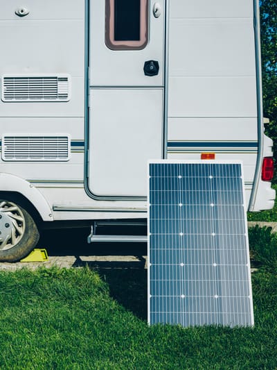
Power. Without shore power, you're running on batteries. How long you can stay depends on your battery bank and whether you have a way to recharge it. Even a portable solar panel extends a one-night trip into a multi-day one. A properly sized lithium battery setup with rooftop solar can keep most rigs running indefinitely in full sun — if you're building that out, our solar setup guide covers every budget. If you're not there yet, a generator covers the gap — most boondockers run them for a few hours in the afternoon rather than continuously. And if your batteries have been giving you trouble at developed campgrounds, here's why that's likely happening and how to fix it before you head somewhere with no shore power to bail you out.
Water. You're carrying whatever is in your fresh tank. Know your capacity, track your usage, and locate your nearest fill station before you head out. Apps like The Dyrt show water fill locations. At a mandatory 200-foot setback from any water source and strict pack-in/pack-out rules, there's no refilling from streams. If you're considering a filtration setup so you can top up from tested sources, these portable water filter systems are built for exactly this situation. A portable gravity-fed water filtration system is worth having as a backup even if you're meticulous about tank management — it removes the risk entirely and costs far less than a single wasted trip.
Waste. Your tanks have a fixed capacity. Plan trip length around it, and know where dump stations are along your route. Most campsite apps include dump station locations. If managing waste capacity is a recurring pressure point, our RV maintenance checklist covers tank inspection and the specific items that extend how long you can stay off-grid between services.
Cell service. It may not exist. Download offline maps before leaving any area with signal.
None of this is complicated — it's just logistics that require a bit more intentionality than pulling into a campground and plugging in. Most people calibrate quickly on their first trip.
The Honest Take on Getting Started
First-timers often overthink it. They worry about getting stuck, running out of power, being too remote, or not knowing what they're doing. That anxiety is understandable and largely unnecessary.
The most sensible first trip is one that's well-reviewed, reasonably accessible, and close enough to a town that you can course-correct if something goes wrong. Read the campsite reviews carefully — experienced campers will tell you road conditions, cell signal, what size rigs fit, and any quirks worth knowing. Start with one or two nights. Get a feel for your power draw, your water use, your tank capacity. Then go further. If you're still in the rig selection phase and want to understand which type works best for off-grid use, our breakdown of what type of RV to buy covers the tradeoffs that matter for boondocking-focused buyers. If coastal camping appeals as a next step, beach RVing for boondockers is a solid follow-up read.
The RVers who make it look effortless weren't born knowing any of this. They did a first trip somewhere, figured out what they didn't know, came back better prepared, and kept going. The process is the same for everyone.
The spots are out there. There are more of them than most people realize, and the tools to find them have never been better.
FAQs
How long can you stay on BLM land for free?
Dispersed camping on Bureau of Land Management land is generally limited to 14 consecutive days within any 28-day period. After 14 days, you must move at least 25 miles from your previous location before the clock resets — this is the 14/28/25 rule. Some specific areas managed by local BLM field offices carry shorter limits, including seven-day and three-day caps near popular destinations or national parks. Always verify the rules for the specific field office managing your intended area before you go.
What is the difference between BLM land and national forest land for camping?
Both allow free dispersed camping without hookups or reservations in most areas. The key practical difference is road access rules: on U.S. Forest Service land, you're required to camp within 150 feet of a designated forest road shown on a Motor Vehicle Use Map (MVUM). BLM dispersed camping is generally more flexible in terms of where you can set up, though both require staying 200 feet from water sources and packing out all waste. BLM land is concentrated in the desert Southwest and Great Basin; national forests cover more of the mountainous West and Pacific Northwest.
Is it legal to camp on BLM land in a large RV or Class A motorhome?
Yes, dispersed camping on BLM land is legal for any vehicle type, including large Class A motorhomes and fifth-wheel rigs, as long as you stay on designated roads and follow all posted rules for the area. The practical limit is road quality — many BLM two-track roads are not suitable for rigs over 30 feet, and turning around can be impossible in tight terrain. Always research road conditions specific to your rig size using current campsite app reviews and, when in doubt, call the local BLM field office to ask about road width and surface conditions before committing.
What happens if you accidentally camp on private land or state trust land instead of BLM?
If you camp on private land without permission, you're trespassing. A landowner can ask you to leave immediately and, in some states, call law enforcement. On Arizona State Trust Land specifically, camping requires a separate $15 annual permit — arriving without one is a violation even if you've done all your BLM research correctly. The fix is to always verify land status using a mapping tool like Gaia GPS or the BLM's own public land mapping tool before you set up, not after you arrive.
Do you need any permits to boondock on BLM land?
In most of the western United States, no permit is required for standard dispersed camping on BLM land — you can simply drive to an allowed area and set up. However, there are exceptions. Arizona's Long-Term Visitor Areas (LTVAs) require a permit for stays longer than 14 days in season. Some high-use areas, such as Alabama Hills in California, now require a free camping permit year-round. Several popular areas issue permits online in advance. Always check the specific requirements for your destination on BLM.gov or by calling the managing field office.
What apps do experienced boondockers actually use to find free campsites?
The most common combination is Gaia GPS (for land ownership and boundary verification), a campsite-specific app like iOverlander or Freecampsites.net (for user-reviewed spots with road condition notes), and, for members, Harvest Hosts (for private property stays in areas where public land is sparse). Many experienced boondockers cross-reference at least two sources before committing to a spot, checking that the land is actually BLM or USFS and that recent reviews confirm the road is accessible for their rig size.
What is the minimum gear setup needed to boondock for a week?
A week of self-sufficient boondocking requires, at minimum: enough battery capacity to run your essential systems (typically 100–200Ah of usable lithium capacity for a modest setup), a way to recharge (solar, generator, or both), a fresh water tank with at least 40–50 gallons and a plan for refilling or filtering, gray and black tanks large enough for your usage pattern (or a portable waste tank to extend capacity), and downloaded offline maps loaded before you leave cell range. A portable tire inflator rounds out the essentials — unimproved roads put more stress on tires than pavement, and being able to adjust pressure or handle a slow leak without driving 30 miles to a gas station is a practical necessity, not a luxury.
Related Posts

Subscribe to the Swervia Newsletter
The best RV stories, tips, and destinations—expertly curated and always free.