These 10 Highways Will Destroy Your RV (And Your Sanity) – Smart Alternatives Inside
Look, we've all been there. You're cruising along, coffee in hand, living your best road life when suddenly your GPS cheerfully announces you're about to enter what can only be described as automotive purgatory. Some highways weren't built with RVers in mind—they were seemingly designed by people who hate big rigs, tall vehicles, and anyone who values their suspension system.
Based on firsthand RVer reports and current road condition data, we've compiled the definitive list of highways that'll turn your dream trip into a white-knuckle nightmare. But here's the good news: for every road from hell, there's usually a much better alternative that'll get you there with your sanity (and your rig) intact. If you're still in the shopping phase and haven't locked in your rig yet, our first-time RV buying guide covers how to choose a rig that's actually built for the roads you're planning to drive.
The Worst Highways for RVs: A Reality Check
Before we dive into our hall of shame, let's be clear about what makes a highway truly terrible for RVers. We're talking about roads with chronic infrastructure problems, extreme weather conditions, or geometric challenges that turn driving into an extreme sport. These aren't just inconvenient—they're genuinely hazardous for large vehicles.
1. Interstate 70 Through Colorado (Eisenhower Tunnel to Vail Pass)
This stretch is basically a masterclass in everything that can go wrong for RVers. The Eisenhower Tunnel restricts vehicles over 13'11" tall, the grades are brutal (up to 7%), and the traffic during ski season turns this into a parking lot at 11,000 feet elevation.
Why It's Dangerous: Sharp curves, steep grades, altitude effects on engine performance, and aggressive car traffic that treats RVs like moving roadblocks.
Alternative Route: Take I-80 north through Wyoming, then I-76 and I-25 south. Yes, it's longer and adds significant miles, but it avoids the elevation and tunnel restrictions.
2. US Highway 50 Through Nevada (The Loneliest Road)
While romantic in name, this route earned its nickname for good reason. With 287 miles between Ely and Fernley containing limited services, it can be challenging if you fear a breakdown with your rig. Cell coverage has improved significantly in recent years, making it more manageable than its reputation suggests, but the remoteness factor remains real.
Why It's Concerning: Long stretches between services, harsh desert conditions, and winds that can reach 60+ mph. If you're anxious about potential mechanical issues, this isn't the route for peace of mind.
Better Alternative: If you're uncomfortable with remote desert driving, stick to I-80 across Nevada. It's busier but offers consistent services every 50-75 miles.
3. Interstate 70 Through Indiana (Especially Eastern Section)
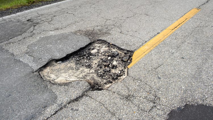
Indiana's I-70, particularly from Indianapolis to the Ohio border, has become notorious among RVers for its deteriorating pavement conditions. INDOT's "Revive I-70" project acknowledges the serious infrastructure problems, with major reconstruction beginning in late 2024. Until repairs are complete, this stretch offers a punishing ride that can damage suspension systems and destroy tires.
Why It's Dangerous: Severe pavement deterioration, massive potholes, and rough patches that haven't kept up with heavy truck traffic.
Better Alternative: Consider I-74 south to I-64 east, or I-65 south to I-64 east to bypass the worst sections, especially if you're heading toward the Ohio Valley.
4. Interstate 80/90 Through Chicago Metropolitan Area
The Chicago area interstates, particularly I-80 and I-90 through the south and northwest suburbs, are consistently ranked among the worst for pavement condition in the nation. The combination of harsh freeze-thaw cycles, heavy truck traffic, and delayed maintenance creates a minefield of potholes that can cause serious damage to RV suspension systems and tires.
Why It's Dangerous: Severe pothole damage potential, extremely heavy traffic, and road surfaces that deteriorate faster than repairs can keep up.
Better Alternative: I-39 north to I-88 west can bypass Chicago entirely if you're crossing Illinois, or time your travel to avoid rush hours and check current construction updates.
5. Highway 550 Through Colorado (Million Dollar Highway)
This mountain pass between Durango and Ouray is stunning but absolutely not worth the risk for RVers. No guardrails, narrow lanes, and grades up to 10% make this a nail-biter even for experienced drivers.
Why It's Dangerous: Extreme elevation changes, no guardrails on cliff sections, and weather that can change from clear to whiteout in minutes.
Better Alternative: Take the longer route via I-25 north to I-70 west, then south on I-15. Your nerves are worth the extra time.
6. Interstate 35 Through Kansas and Oklahoma
This north-south corridor can get sustained winds up to 70 or 80 miles per hour, and when you're piloting a 30-foot sail down the highway, that's not just uncomfortable—it's dangerous. The combination of crosswinds and heavy truck traffic creates a perfect storm for accidents. Our complete guide to towing a travel trailer covers how weight distribution and load balance affect stability in high-wind conditions — worth reading before you tackle this corridor.
Why It's Dangerous: Extreme crosswinds, frequent severe weather, and a high accident rate during storm season.
Alternative Route: During severe wind conditions, you may need to wait it out or detour significantly. There isn't a direct alternative since this is a north-south corridor, but monitoring wind forecasts and planning stopping points becomes crucial.
7. US Highway 2 Through North Dakota and Montana
While beautiful, this northern route is a nightmare during winter months. Frequent closures, blizzard conditions, and limited services make it a poor choice for RVers, especially full-timers trying to maintain schedules.
Why It's Dangerous: Extreme winter weather, frequent road closures, and long stretches without services.
Better Alternative: I-94 runs parallel and is much better maintained with more consistent snow removal and services.
8. Interstate 15 Through the Mojave Desert (California/Nevada Border)
The most hazardous segment of the I-15 highway in California lies between Exits 138 and 129, situated in Hesperia, but the entire desert section is problematic for RVers due to extreme heat, steep grades, and frequent accidents.
Why It's Dangerous: Steep Cajon Pass grades, extreme summer temperatures that cause overheating, and heavy traffic mixing RVs with high-speed cars.
Better Alternative: During summer months, consider I-40 to I-5 north, avoiding the worst desert conditions.
9. US Highway 12 Through Idaho (Lochsa River Corridor)
This winding mountain road follows the Lochsa River and is absolutely gorgeous—but it's also a white-knuckle experience for RVers. Tight curves, steep grades, and no guardrails make this route best left for smaller vehicles.
Why It's Dangerous: Extremely winding with tight radius curves, steep grades, and limited escape routes.
Better Alternative: I-90 through Montana is your friend here, even though it means extra miles.
10. Highway 1 Along California's Coast (Big Sur Section)
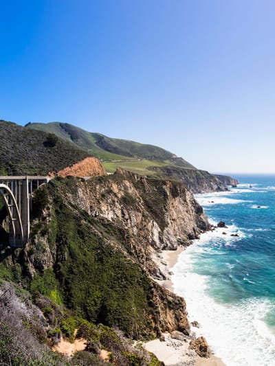
Yes, it's Instagram-worthy, but a city like San Francisco is perhaps the most challenging to drive an RV through as you've also got drastic elevation changes to contend with. The Big Sur section is particularly problematic with its narrow lanes and frequent closures due to landslides.
Why It's Dangerous: Narrow lanes, frequent landslides, limited passing opportunities, and seasonal closures.
Better Alternative: US-101 inland provides coastal access without the drama.
Smart Planning: How to Check Road Conditions Before You Roll
The key to avoiding RV road hazards isn't just knowing which routes to avoid—it's staying informed about current conditions. Here are the essential resources every full-timer should bookmark. And before you hit any of these routes, run through our RV maintenance checklist to make sure your rig is road-ready — a weak tire or failing battery makes every highway on this list more dangerous.
Real-Time Condition Resources
- 511 Systems: Most states offer phone (dial 511) and web-based traffic information
- Weather.gov Mountain Pass Conditions: Essential for western travel
- TruckerPath App: Crowd-sourced information from professional drivers
- iExit App: Shows services and conditions at upcoming exits
A solar-powered tire pressure monitoring system is worth adding to your setup before tackling any of these routes — it gives you real-time readings on all tires so you catch pressure drops before they become blowouts on a steep grade or in a remote stretch.
State-Specific Resources
- Colorado: COtrip.org for mountain pass conditions
- California: QuickMap for chain requirements and closures
- Montana: MDT Road Report for weather conditions
- Wyoming: WYDOT for wind warnings and closures
Wind Risk Zones: When to Pull Over
Understanding highway condition reports isn't just about weather—it's about recognizing when conditions become dangerous for high-profile vehicles. Here's what full-timers need to know:
High Wind Warnings: When sustained winds hit 25 mph with gusts over 35 mph, it's time to find a safe place to wait it out. Your rig is essentially a sail, and physics isn't negotiable.
Common High-Wind Areas:
- Great Plains corridors (I-80, I-76, I-25)
- Desert passes in Nevada and California
- Columbia River Gorge in Oregon/Washington
- Bridge crossings anywhere
If crosswinds are a recurring concern for your routes, a weight distribution hitch with sway control makes a measurable difference in how your trailer tracks under those conditions — particularly on open highway stretches with no windbreaks. For backing up and maneuvering in tight pull-throughs after a long wind-taxed drive, a magnetic solar wireless backup camera that mounts without drilling is one of those additions that pays for itself in stress reduction alone.
Planning routes around rough highways takes the same kind of prep as any other part of the trip. Subscribe to our weekly newsletter.
ROUTES RESEARCHED. GEAR REVIEWED. DELIVERED EVERY WEDNESDAY, FREE.
Alternative Route Planning: The Smart RVer's Approach
When planning routes around dangerous truck routes, remember that the shortest distance between two points might be a straight line, but it's not always the smartest line for RVers. Consider these factors. For a deeper look at which parts of the country are worth building detours around versus which ones are worth the scenic miles, our destinations guide to RV-accessible swimming holes shows how many of the best stops in the country sit right off the safer alternate routes anyway.
Grade Considerations: Anything over 6% grade requires extra planning, especially if you're towing. A 4-point sway control weight distribution hitch is not optional on steep grades with a loaded trailer — it's the difference between controlled descent and a very bad afternoon. (Note: this is the same product mentioned above — if you've already noted it, skip to the backup camera above as your second affiliate reference for this section.)
Service Intervals: Never plan routes with more than 100 miles between fuel stops in remote areas.
Weather Seasonality: Mountain passes in winter, desert routes in summer—timing matters more than distance.
Weight Restrictions: Some states have seasonal weight limits that can affect where you can legally travel.
For RVers who are full-timing or spending extended time on western routes, understanding how the full-time RV lifestyle actually pencils out financially — including the cost of unplanned repairs from road damage — changes how you think about route risk entirely.
When Good Highways Go Bad: Seasonal Considerations
Even normally safe routes can become dangerous under certain conditions. Here's when to reconsider your planned route. For a broader look at where to go by season without ending up on the wrong side of a pass closure, our guide to the top national parks for RV camping in the West includes timing and access notes for each park's road conditions.
Spring: Mountain passes may still have snow despite warm valley temperatures. Always check current conditions, not just forecasts.
Summer: Desert routes become genuinely dangerous for RVs without adequate cooling systems. Plan for early morning travel and afternoon breaks.
Fall: This is generally the best time for RV travel, but watch for early winter storms in mountain areas.
Winter: Stick to southern routes unless you have extensive cold-weather experience and proper equipment. Our beach RVing guide is worth bookmarking as a winter routing resource — coastal Gulf and Southeast routes stay open year-round and keep you clear of the passes entirely.
The Bottom Line: Your Rig, Your Rules
Here's the truth about RV road hazards: the worst highway for RVs is always the one you're not prepared for. Whether that's a mountain pass in a snowstorm or a desert highway in August with a failing cooling system, preparation beats route selection every time.
That said, some roads are genuinely more dangerous than others, and there's no shame in taking the longer, safer route. Full-time RVing is about the journey, not proving you can handle the most challenging roads out there.
Your rig is your home, your transportation, and probably your biggest investment all rolled into one. Treat it accordingly. When in doubt, take the interstate. When the weather's questionable, wait it out. When the GPS suggests a "shortcut" through a mountain pass you've never heard of, politely decline.
Before you head out on any of the routes we've flagged here, run the numbers on where your rig actually stands. Our RV shore power hookup guide is a good place to start for electrical prep, and our RV battery guide covers the power reliability issues that turn a manageable desert detour into an actual emergency. A battery monitor installed before you hit any of the remote stretches on this list gives you real-time state-of-charge data so you're never guessing. And a reliable portable tire inflator stowed in your bay means that the pothole damage from Indiana's I-70 doesn't strand you waiting for a roadside service call.
FAQs
What makes a highway dangerous for RVs specifically?
RVs face road hazards that cars don't register the same way. High-profile vehicles are significantly more vulnerable to crosswinds, with sustained winds above 25 mph and gusts over 35 mph creating genuine rollover risk on open corridors. Grades above 6% stress transmissions and brakes on heavy rigs. Tunnel height restrictions — like the 13'11" limit at Colorado's Eisenhower Tunnel — can simply make certain routes physically impassable. Pavement quality matters more in a rig with 10 to 20 tires than in a passenger car, because a single bad pothole can cause suspension damage, tire failure, or worse.
What is the most dangerous highway for RVs in the United States?
There is no single universally ranked answer, but Interstate 70 through Colorado — specifically the Eisenhower Tunnel to Vail Pass corridor — consistently tops RVer difficulty lists due to its combination of height restrictions, grades up to 7%, altitude effects on engine performance, and heavy seasonal traffic. Highway 550 in Colorado (the Million Dollar Highway between Durango and Ouray) is considered the most technically dangerous for large vehicles due to its narrow lanes, grades up to 10%, and absent guardrails on cliff-edge sections.
How do I check road conditions before an RV trip?
Most states operate a 511 phone and web system for real-time traffic and road conditions. For mountain travel specifically, Colorado's COtrip.org, California's QuickMap, Montana's MDT Road Report, and Wyoming's WYDOT site provide pass conditions, chain requirements, and closure information. TruckerPath is a crowd-sourced app used by professional drivers that provides ground-level road condition reports and is particularly useful for interstate routes through high-traffic commercial corridors.
Can I drive a large RV on Highway 1 in California?
Technically yes on most sections, but the Big Sur stretch is not recommended for large rigs. Lanes are narrow, passing opportunities are extremely limited, and the route is subject to seasonal closures due to landslides — sometimes lasting weeks or months. The Big Sur section has no practical alternative except retracing your route. US-101 inland is the standard recommended alternative for RVs traveling the California coast, providing similar regional access without the hazard profile.
What wind speed is too dangerous for RV driving?
The general threshold used by experienced full-timers is sustained winds at 25 mph with gusts exceeding 35 mph. At that point, a standard travel trailer or Class A motorhome becomes difficult to control safely, particularly on exposed highway sections like the Great Plains corridors, desert passes in Nevada and California, and bridge crossings. Crosswind risk is compounded by the weight and slide-out configuration of the rig. When in doubt, pull off and wait — most serious RV wind accidents occur when drivers continue through conditions they recognized as dangerous.
What is the best alternative route to avoid I-70 through the Eisenhower Tunnel in Colorado?
The most commonly recommended alternative for RVers who can't clear the 13'11" Eisenhower Tunnel height restriction is I-80 north through Wyoming combined with I-76 and I-25 south into Colorado. This adds significant miles but eliminates the tunnel restriction, the 7% grades, and the extreme elevation. The Wyoming routing also tends to have more consistent road conditions and far less ski-season congestion.
How can I protect my RV on rough highways before the trip?
Before driving any of the routes flagged in this article, confirm your tire pressure and condition, check your battery state of charge, verify all slide-out seals and roof seams for any existing stress points, and make sure your surge protector and electrical adapters are in your bay. Installing a tire pressure monitoring system before remote stretches gives you real-time data on all tires while driving. Carrying a portable tire inflator means that minor pressure loss from road damage doesn't require a service call to resolve.






Categories
Related Posts


Subscribe to the Swervia Newsletter
The best RV stories, tips, and destinations—expertly curated and always free.