Things to Do in Death Valley, Sorted by What Your RV Can Reach
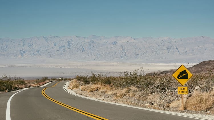
Walk out onto the salt at Badwater near sunset and the crunch under your boots is the only sound for a mile in any direction. An hour later you're eating dinner outside the RV in a fleece. After dark the Milky Way comes up so bright it reads like a second landscape hung over the first one. Death Valley does this all week. It keeps handing you moments that sound made up when you describe them at home.
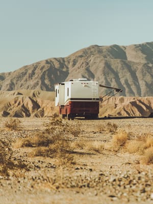
The catch with any list of things to do in Death Valley is that the park is enormous and almost nothing in it sits next to anything else. The dunes, the crater, the ghost town and the painted hills are each an hour from the others, in four different directions, and a few of the roads between them have opinions about how long a vehicle they'll accept. Pick your stops by how good the photo looks and you'll spend the trip in the driver's seat.
So this list is built around what you'll actually be doing. Hike. Drive. Wander the dunes. Stargaze. Poke through the wreckage of a few mining booms. Ride a bike. Leave the park for a day and come back hungry for more. Under every stop is the one thing you need to know before you unhook: paved lot, short gravel spur, or a road your RV sits out while a smaller vehicle goes in. Zabriskie Point, Badwater and the dunes are the must-see stops in Death Valley on every list for a reason, and every one of them is reachable in the biggest RV on the road.
Go in the cool season, November into March, when the trails are walkable at noon and the campgrounds have a site for you; when to visit Death Valley walks through the months. If you haven't picked your nights yet, the Death Valley winter itinerary puts these stops in driving order over four days.
Death Valley Hikes That Start in a Paved Lot
The best Death Valley hikes for an RV trip start in paved lots: Golden Canyon, Ubehebe Crater's rim, and two short canyon walks reached by gravel spurs the park rates passable to ordinary cars.
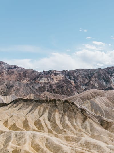
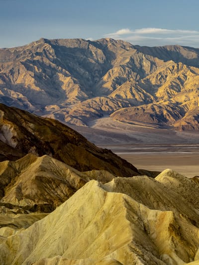
Start with Golden Canyon. The trail leaves an ordinary paved lot off Badwater Road and climbs into a wash between walls the color of a lion, narrowing as it goes, until a rust-red cliff called Red Cathedral fills the end of the canyon and glows when the sun finds it. That out-and-back runs about three miles. Link it with Gower Gulch and you get a loop of a little over four miles through the same folded badlands people photograph from Zabriskie Point, except now you're inside them. There's also a shorter badlands loop that connects to Zabriskie, so the same trailhead serves an hour or a morning.
Mosaic Canyon is the other one worth planning around. A gravel road of a couple of miles leaves Stovepipe Wells and ends at a canyon whose lower walls are marble, water-polished to a shine you'll want to run a hand along. The narrows come early, so a family can turn around after twenty minutes and still feel they did it. Go to the end and it's a four-mile round trip with real climbing.
Ubehebe Crater sits an hour north of Furnace Creek at the end of a paved road, and the lot on the rim is built for buses. Two thousand years ago rising magma hit groundwater here and the steam blew a hole half a mile across and several hundred feet deep. The rim loop is a mile and a half with a few hundred feet of gain and edges that drop away on one side. Going down to the floor is allowed. Coming back up is a slog through ankle-deep cinders, so decide at the rim, not at the bottom.
Two short ones round it out. Natural Bridge is a mile round trip up a gravel spur to a rock arch you walk under. Salt Creek is a half-mile boardwalk over a stream that shouldn't exist here, home to a pupfish found nowhere else on Earth; water reaches the boardwalk from late fall into spring, and the boardwalk is wheelchair-accessible.
The mountain hikes are a different day. Wildrose Peak and Telescope Peak both sit behind the 25-foot vehicle limit on Emigrant Canyon Road, so anything longer than that plans them from somewhere else. The National Park Service calls November through March the best hiking season in Death Valley and asks for at least two liters of water per person even on a short winter walk. Carry it in an insulated water bottle and you'll actually drink it, because warm water on a canyon floor is the kind you ration instead.
The Death Valley Drive: Badwater Road, Artists Drive and the Twenty-Five-Foot Line
A Death Valley scenic drive isn't the way to the activity. Here the drive is the activity, and the park has paved most of the good ones.
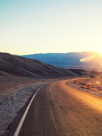
Badwater Road is the spine. It runs south from Furnace Creek along the valley floor for a little over an hour of sightlines, and it ends at a paved lot with spaces sized for buses and big RVs. Badwater Basin is 282 feet below sea level, the lowest ground in North America, and the walk out onto the salt is a mile or two round trip across a crust that crunches like frozen snow. Look back at the cliff behind the lot and there's a small sign, far up the rock, marking where sea level would be. On the way, a short gravel spur leads to the Devils Golf Course, a plain of salt crystals so jagged the old guidebooks said only the devil could play it. Stand still and you can hear them tick and pop as they expand in the heat.
Artists Drive is the one that hurts to skip. Nine miles, one way, paved, climbing through hills stained pink and green and violet by iron and chlorite in old volcanic ash. The park closes it to anything over 25 feet long or 9 feet wide, and to anything towing, because the dips are tight enough that a long wheelbase drags. The same limit applies to Dantes View Road, which climbs to a ridge more than a mile above the salt you stood on, about 45 minutes from Furnace Creek, and looks straight down at it.
Twenty Mule Team Canyon is the unpaved one-way loop near Zabriskie Point where the limit is a recommendation rather than a rule, and where the borax wagons actually ran through bare yellow badlands. Leashed dogs are allowed on this road, one of the few places in the park a dog can walk through the badlands.
Heading west, CA-190 climbs out of the valley toward Father Crowley Vista, a paved lot with a vault toilet and a view down into Rainbow Canyon. It's the drive out for anyone leaving toward the Sierra, and worth a stop even if you're turning around.
Death Valley isn't unusual about length limits, just strict about them. The same pattern shows up in our look at RV size limits on Yellowstone's roads. The long paved distances and the sharp gravel spurs wear on tires, and a tire-pressure monitor matters more here than in most parks, because the nearest tire shop is a long way off.
Walk the Dunes at Mesquite Flat
The dunes at Mesquite Flat exist because this corner of the valley is a trap. Wind strips sand off the eroding mountains, hits a wall of rock, and drops its load in the same place, century after century, until there's a hundred feet of rippled sand with no ocean for two hundred miles in any direction.
You walk them. There's no trail because there can't be; the wind erases footprints overnight, so every morning the dunes look as if nobody has ever been there. Go at sunrise or the last hour before sunset, when every ripple throws a shadow and the whole field turns to corduroy. Under a full moon you don't need a headlamp. The tallest dune is about two miles round trip from the lot with 185 feet of climbing, and sand makes that feel like double.
The lot is paved, with pull-through spaces for large RVs, right off CA-190 by Stovepipe Wells, so this is one of the easiest big stops in the park for a motorhome. Dogs are not allowed on the dunes, even carried. Drones are banned park-wide, so leave it home.
Subscribe to our weekly newsletter.
PLAN THE DEATH VALLEY STOPS YOUR RV CAN ACTUALLY REACH. FREE, EVERY WEDNESDAY.
Death Valley Stargazing in the Darkest Park in the Country
DarkSky International rates Death Valley a Gold Tier Dark Sky Park, the highest rating it gives. In practice that means the Milky Way casts a faint shadow on a moonless night, and Death Valley stargazing needs no equipment beyond a chair and a jacket.
Drive ten minutes from the campground, kill the headlights, and give your eyes twenty minutes. The places that work best are the same paved lots you used all day: Mesquite Flat, Badwater, Harmony Borax Works, Zabriskie Point, Ubehebe Crater. Each February the park runs a Dark Sky Festival with ranger programs and telescopes at those same spots, so if your trip lands then, check the program list before you plan an evening.
Death Valley photography goes better with a little astronomy. The bright core of the Milky Way is a summer object, low in the south after dark; winter trades it for Orion, the longest nights of the year, and cold, dry, steady air. A pair of astronomy binoculars on a tripod shows the Orion Nebula as a real cloud and the Pleiades as a hundred stars instead of seven. Bring a wearable camp blanket, because the desert gives back all its heat to that clear sky by about an hour after dark and you'll want to stay out longer than your coat planned for.
Borax, Kilns and a Name: Death Valley's History You Can Stand In
Harmony Borax Works, just north of Furnace Creek, is where the twenty-mule teams came from. In the 1880s crews scraped borax off the salt flats, boiled it down in this adobe plant, and hauled it 165 miles across the desert to the railhead at Mojave behind teams of eighteen mules and two horses pulling double wagons. The plant ran for only about five years, but the wagons became the most famous advertising image in America. One still sits at the ruins, and it's bigger than you're picturing. A paved loop of less than half a mile circles the site, dogs are allowed on it because it's a developed area, and the Borax Museum back at Furnace Creek holds the rest of the story.
Wildrose Charcoal Kilns are ten stone beehives lined up in a canyon in the Panamints, built in 1877 to turn pinyon into charcoal for silver smelters 25 miles away. They ran about two years and have stood empty ever since, so well built that you can still smell smoke inside them. The gravel road to them is the last stretch of Emigrant Canyon Road, which carries the 25-foot vehicle limit, so the kilns share a day with Wildrose and Telescope Peak.
The name Death Valley comes from a party of gold-rush emigrants who took a shortcut in the winter of 1849 and spent weeks trapped on the valley floor. When they finally climbed out, the park's own account has one of them turning back at the pass to say "goodbye, Death Valley." You can stand at Zabriskie Point and see the ground they were looking at.
Death Valley Activities Beyond the Hikes: Bikes, Rangers and the Backcountry Roads
Death Valley activities don't stop at the trailhead, and three of them get skipped by people who only came for the views.
Bikes are allowed on every park road, paved or dirt, and prohibited on every trail. For the driver of a long RV, that turns Artists Drive from a road you can't use into a nine-mile ride through painted hills with the traffic flowing one way behind you. The park describes hundreds of miles of dirt roads for mountain biking and warns that the paved roads have narrow shoulders, so ride the paved ones early, before the day-trippers arrive.
Ranger programs run through the cool season: guided walks, patio talks at the visitor center, and night programs under that sky. Ask at Furnace Creek when you arrive; the schedule changes with the season and the staff.
Backcountry roads are the thing people with a capable vehicle come here for. The park has hundreds of miles of them, from graded gravel to two-track, and two rules apply to all of it: no off-highway vehicles anywhere in the park, and no driving off the road, ever. Everything you'd need to know about water and heat on those roads is in our desert boondocking guide, because the math is the same.
Things to Do Near Death Valley: Rhyolite Ghost Town and the Road to Beatty
The best thing to do near Death Valley is a dead city. Rhyolite Ghost Town sits four miles west of Beatty, Nevada, at the end of a paved road, so it works as an RV day. Gold was found here in 1904, and within a few years several thousand people had built a town with a stock exchange, an opera house, electric lights and a three-story bank. The money ran out almost as fast as it came, and by the 1920s the town was empty. What's left is the bank's concrete skeleton, a 1905 train depot that outlasted the railroad, and a house built from fifty thousand beer and medicine bottles because lumber was scarcer than glass. It's managed by the Bureau of Land Management, free, and open for day use.
Next door, the Goldwell Open Air Museum is a sculpture park that started in 1984 when a Belgian artist arranged a dozen ghostly plaster figures in the poses of The Last Supper against the Amargosa Desert. They're still there, along with a two-story pink woman built from cinder blocks. The grounds are open all the time and free to walk.
South of the park at Death Valley Junction, the Amargosa Opera House still gives daily tours of the hall where a New York dancer painted herself an audience on the walls and performed to it for decades. And for the pupfish-curious, Ash Meadows National Wildlife Refuge across the Nevada line protects the spring-fed pools where the fish that survived the vanished lake still swim.
What's Closed, and What Your RV Can't Reach
Death Valley's roads wash out on their own schedule and get rebuilt on a slower one.
Three are closed this year. Titus Canyon Road, the one-way canyon drive from Nevada, is closed for repairs through September 2027. Scotty's Castle, the 1920s mansion at the north end, has been shut for flood recovery for years with no reopening date, and the closure includes walking in. The road to Darwin Falls is gone in places; the park now describes the waterfall as a seven-mile round-trip hike from the highway shoulder, which turns a stroll into an expedition. Check the park's current conditions page the week you leave, because that list changes after every storm.
Two more are open and not happening in the RV. The Racetrack, where boulders leave long trails across a dry lakebed, sits 26 miles of sharp washboard past Ubehebe Crater; the park says good tires, four-wheel drive and high clearance are usually required, that rentals get flats, and that it's at least three and a half hours each way from Furnace Creek. The rocks move when a skin of rain freezes into thin ice sheets and the wind pushes them, which is stranger than any legend about it. Eureka Dunes, the tallest in California at more than 680 feet, sit at the end of a long gravel road in the far north, and sandboarding is prohibited there. Come back for them with a different vehicle.
Bringing a Dog to Death Valley
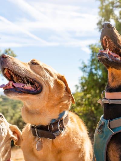
The rule is stricter than most parks. Pets stay within 50 feet of a road or a developed area, on a leash, and are prohibited on all trails, in all wilderness, and on the dunes, even if carried. Four per campsite.
What that leaves is more than it sounds. The drives are all fair game, including the pullouts along Badwater Road and the walk out from the Badwater lot as long as you stay within the developed area. Harmony Borax's paved loop is a developed site, so the dog can do the history. Twenty Mule Team Canyon Road is a dirt road, not a trail, so a leashed dog can walk its whole length through the badlands, and the park's own FAQ names it as a good one to try. And the campground at night, with that sky, is where most dogs will be happiest anyway. The general rules for dogs in national parks apply here too. In open desert with no fences and coyotes that come through camp, a GPS dog collar is worth more than it is at any fenced campground.
Come for the Verbs
The best things to do in Death Valley are reachable in whatever you're driving. Plan two days around the paved lots, give the sky both nights, and put Artists Drive on a bike if the RV is too long for the road. The Death Valley itinerary we built for a winter week puts those days in driving order. Everything that isn't specific to this park, from reservations to dump stations, is in our guide to RVing in national parks.
The Short Version
- The hikes: Golden Canyon, Mosaic Canyon, Ubehebe Crater's rim, Natural Bridge and Salt Creek all start in paved lots or short gravel spurs. Wildrose and Telescope Peak sit behind the 25-foot limit.
- The drives: Badwater Road and CA-190 are wide open. Artists Drive and Dantes View Road are closed to anything over 25 feet or towing. Twenty Mule Team Canyon carries the same limit as a recommendation.
- The dunes: paved lot with RV pull-throughs at Mesquite Flat. Go at sunrise, sunset or full moon. No dogs on the sand.
- The sky: Gold Tier dark sky. Any paved lot ten minutes from camp, twenty minutes of dark, no gear required.
- The history: Harmony Borax Works, the Wildrose Charcoal Kilns, and the story behind the name.
- Beyond the boundary: Rhyolite and Goldwell on a paved road out of Beatty.
- Closed: Titus Canyon Road through September 2027, Scotty's Castle, the Darwin Falls road. The Racetrack and Eureka Dunes need a different vehicle.
- Dogs: roads, pullouts, developed areas and campgrounds only.
FAQs
What is there to do in Death Valley?
Hike canyons that start in paved lots, drive the valley floor to the lowest point in North America, walk the dunes at Mesquite Flat, stargaze under a Gold Tier dark sky, stand in the ruins of the borax works, ride a bike through Artists Drive, and spend a day in a Nevada ghost town just outside the boundary. Most of it is reachable in any size RV. The exceptions are Artists Drive and Dantes View Road, which ban vehicles over 25 feet, and the Racetrack and Eureka Dunes, which need high clearance.
Can you hike in Death Valley on an RV trip?
Yes, and the best hikes are the easy ones to reach. Golden Canyon leaves a paved lot off Badwater Road and runs three miles to Red Cathedral or a little over four as a loop through Gower Gulch. Ubehebe Crater's rim loop is a mile and a half from a paved lot built for buses. Mosaic Canyon and Natural Bridge are reached by short gravel spurs the park rates passable to ordinary cars. Wildrose Peak and Telescope Peak sit behind the 25-foot limit on Emigrant Canyon Road. The National Park Service calls November through March the best hiking season.
Is Death Valley good for stargazing?
It's one of the best places in the country for it. DarkSky International rates Death Valley a Gold Tier Dark Sky Park, its highest rating, and the park hosts a Dark Sky Festival every February with ranger programs and telescopes. Any paved lot ten minutes from camp works: Mesquite Flat, Badwater Basin, Harmony Borax Works, Zabriskie Point or Ubehebe Crater. Give your eyes twenty minutes and the Milky Way is bright enough to cast a shadow on a moonless night.
Can you bring a dog to Death Valley?
Yes, with limits stricter than most parks. Pets must stay within 50 feet of roads and developed areas on a leash, and they're prohibited on all trails, in wilderness, and on the dunes, even if carried, with a maximum of four per campsite. That leaves the scenic drives and their pullouts, the paved loop at Harmony Borax Works, the dirt road through Twenty Mule Team Canyon, and the campground at night under the dark sky.
How did Death Valley get its name?
A party of gold-rush emigrants took a shortcut toward the California goldfields in the winter of 1849 and spent weeks trapped on the valley floor, burning their wagons and walking out over the mountains. According to the National Park Service, as they climbed out, one of the men turned, looked back, and said "goodbye, Death Valley." The name stuck. You can look at the same ground they left from Zabriskie Point.
What animals live in Death Valley?
More than the name suggests. Coyotes, kit foxes, ravens, roadrunners and ground squirrels are common on the valley floor, and desert bighorn sheep live in the mountains. Salt Creek is home to a pupfish found nowhere else on Earth, a survivor from the lake that filled the valley thousands of years ago; you can watch them from the boardwalk in spring. Wild burros roam the country around Beatty just outside the park.
How many days do you need in Death Valley?
Two full days covers the paved-lot list: Badwater Road and Golden Canyon on one, Mesquite Flat and Ubehebe Crater on the other, with the dark sky both nights. Add a third for the 25-foot-limit roads if your setup allows it, and a fourth for Rhyolite or the mountain hikes. The park is 3.4 million acres and the stops are 20 to 60 miles apart, so a two-hour round trip between activities is normal. Our four-day Death Valley winter itinerary sequences all of it around where the RV is parked.
Categories
Related Posts
Subscribe to the Swervia Newsletter
The best RV stories, tips, and destinations—expertly curated and always free.