Stowe Hikes for RVers: 12 Trails From Easy to Hell Brook
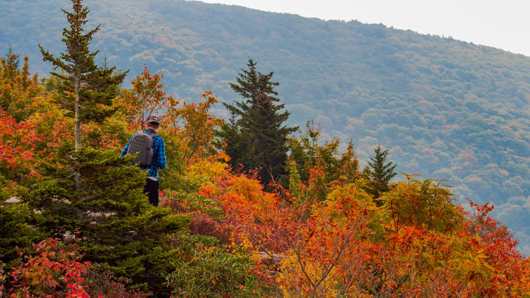
Some people come to Stowe for the ice cream, the covered bridge, and an afternoon floating the reservoir, and they go home happy without ever lacing up a boot. That is a real vacation, and nobody has to apologize for it. But the same valley that hands you cider donuts and a lake also stacks its trails tighter than almost anywhere in the East, from a paved path a stroller can handle to a rock climb with metal bars bolted into the ledges.
That range is the useful part. Vermont's highest summit and a quarter-mile waterfall walk share the same fifteen-minute radius from Stowe Village, which means the mountain never dictates the day. You do, over coffee, based on the weather and whichever legs woke up sore.
This guide sorts the best stowe hikes into three honest tiers, easy to strenuous, with the round-trip mileage, the climb, and the part that actually matters for RVers: where you park a tow vehicle and which trailheads your RV has no business near. Every trail here works as a day trip from one campsite, the same set-up-once approach behind our Adirondacks RV itinerary across Lake Champlain. If you are basing on the New York shore instead, our Adirondack day hikes for RVers covers the summits on the far side of the water.
How These Trails Sort Out, and the One Road Your RV Can't Take
Before the trail list, one road governs everything. Route 108 climbs through Smugglers' Notch, a boulder-choked pass that Vermont's transportation agency closes to single vehicles over 40 feet and any vehicle-and-trailer combination over 45 feet. Several of the best trailheads here sit right on that road: Bingham Falls below the narrows, and Sterling Pond, Hell Brook, and the Long Trail summit route up near the top of the pass. You reach all of them in the tow vehicle, never the RV, and only after the pass opens around mid-May and before it closes in mid-October. The rest of the trailheads sit south of the Notch and stay reachable year-round.
That is the whole logistics story: leave the RV level at camp, drive the tow vehicle to the trail, and treat the roadside pull-offs as first-come. Most of them are small, and on a bright July Saturday the popular ones fill by nine. An early start is less about beating the heat than about finding a legal place to leave the truck. Vermont's climbs are steep enough on the paved roads alone that our first-time towing guide is worth a read before you tackle the grades into the valley, Notch or no Notch.
Easy: Short Walks and Waterfalls for Any Set of Legs
These four ask almost nothing and give back a lot. They are the arrival-day walks, the recovery-day walks, and the trails you send the whole group on when ages span four decades.
Stowe Recreation Path
The gentlest option in the valley is not a climb at all. The Stowe Recreation Path is a paved greenway that runs about 5.3 miles from the village along the West Branch of the Little River, flat the whole way, with Mt. Mansfield filling the sky to the west. Walk a mile of it or the whole thing; it is stroller-friendly, bike-friendly, and dotted with spots to step down to the water. Parking is easy in the village, which is exactly where you want the tow vehicle after a travel day anyway.
Moss Glen Falls
North of the village off Randolph Road, Moss Glen Falls is a tall, narrow cascade that pours into a rock amphitheater about a quarter mile from the trailhead. The walk in is short and mostly level, the kind of scenery-per-step that makes it a perfect first-evening stretch. One warning that catches people every summer: this is the Stowe Moss Glen Falls, not the taller one two hours south in Granville. Vermont named two waterfalls the same thing and left the GPS to sort out the confusion.
Sunset Rock
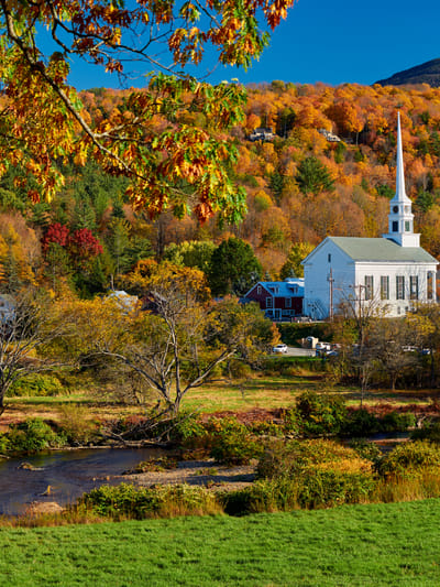
For a real view on a small budget, Sunset Rock climbs straight out of the historic village, about 1.1 miles round trip and roughly 330 feet up, to a ledge looking back over the church steeple and the valley. It is short enough to slot into a half-day and steep enough to feel like you did something, with a second viewpoint at the Upper Overlook for anyone who wants a few more minutes of climbing. Because it starts in town, you can walk it from a village campsite and leave the truck parked.
Bingham Falls
Bingham Falls is the shortest trail on this list, about half a mile round trip, but it earns its place on the easy tier with an asterisk. The distance is nothing; the footing is everything. The path drops down wet granite to a gorge and a deep green plunge pool, and the last stretch is a genuine scramble on slick rock where flip-flops end trips. Wear real shoes, take the descent slowly, and it becomes the best short hike in the valley. The trailhead is on Route 108, below the Notch narrows, so the tow vehicle reaches it fine while the pass is open.
Treat this one as a look, not a swim. Stowe Mountain Rescue was called to Bingham six times in 2020 alone, a visitor drowned in the plunge pool that September after slipping on the sloping rock at the base, and the team's published position is that they have to advise against the jumping spots. Standing at the bottom of the falls is genuinely worth the half mile. Our guide to RV-accessible swimming holes has the spots that are actually built for getting in the water.
Twelve trails sorted so you never waste a morning on the wrong one. Subscribe to our weekly newsletter.
TRAIL-TESTED PICKS, HONEST DRIVE TIMES, AND WHERE TO SWIM AFTER — EVERY WEDNESDAY, ONE FREE EMAIL.
Moderate: Real Climbs That Still Get You Back for Lunch
These four cost you a morning and some breath, but they hand back the views that make people fall for the Green Mountains. None of them are all-day commitments, and all of them are done by early afternoon if you leave camp reasonably early.
Cady Hill Forest
Just south of the village, Cady Hill Forest is not a single trail but a network of about 11 miles of interlaced paths through the woods, best known to mountain bikers but wide open to hikers who want to choose their own distance. This is the trail system for a day when the group can't agree on ambition: a family can do a gentle out-and-back near the lot while a stronger walker links a longer loop, and everyone finishes at the same trailhead. Signage is good, the grades are forgiving, and the parking area sits right off the Mountain Road, no Notch driving required.
Nebraska Notch via the Lake Mansfield Trail
West of town, the Lake Mansfield Trail to Nebraska Notch runs about 3.8 miles round trip and climbs a modest 970 feet through some of the prettiest low-mileage terrain around Stowe: hardwoods, beaver meadows, and rock outcrops leading up to Taylor Lodge and the mouth of the notch itself. It starts near the Lake Mansfield Trout Club on a dirt road, so take the last stretch slowly in the tow vehicle. The payoff is quiet; this is the moderate hike for people who would rather trade the crowd for the beavers.
Stowe Pinnacle
The local favorite for a reason, Stowe Pinnacle packs a full panorama into a short, steep push, about 2.8 miles round trip with roughly 1,500 feet of climbing to a rocky knob. From the top, Mt. Mansfield, Camel's Hump, the Worcester Range, and the Waterbury Reservoir all lay out at once, which is a lot of Vermont for under two hours of work. The trail climbs hard through hardwoods before it loops around to the summit rock, so it is honest exercise, not a stroll, but it is the one to pick when you want the big-mountain feeling without the big-mountain day.
Sterling Pond
At the very top of Smugglers' Notch, across from the visitor center, the Sterling Pond Trail climbs steeply about 2.5 miles round trip to an alpine pond sitting near 3,000 feet, one of the highest bodies of water in Vermont. The grade is stiff for the distance and the footing is rooty, but the pond at the top, ringed by spruce with the ridge reflected in it, does not feel like something you reached in barely a mile of climbing. The trailhead is on Route 108 near the crest of the pass, so it is tow-vehicle-only and open only when the Notch is, roughly mid-May through mid-October. Parking is a handful of pull-offs that vanish early on weekends.
Strenuous: Mount Hunger and the Roof of Vermont
Now the trails that make you feel it the next day. Three of these four converge on the same place, the summit ridge of Mt. Mansfield, by wildly different means. Read the group and the forecast honestly before you commit; these are the days where good footwear and real water stop being optional.
Mount Hunger
South in Waterbury, Mount Hunger via the Waterbury Trail is about 4 miles round trip and climbs roughly 2,300 feet to a bare quartzite summit with one of the widest views in central Vermont, Mansfield and Camel's Hump front and center, the Whites off east on a clear day. The last push is a scramble up open rock, and the trail earns its strenuous rating on the way up more than the distance suggests. The access road is rough near the trailhead, so mind the tow vehicle's clearance on the final approach. This is the summit to pick if you are basing near Waterbury and want the roof-of-Vermont feeling without touching the Notch.
Mt. Mansfield via the Toll Road and Ridge Walk
Not everyone wants to earn the summit with 2,800 feet of climbing, and Stowe has the answer built in. The Auto Toll Road is a 4.5-mile gravel road that carries the tow vehicle, never the RV, from the resort base to a parking area near the Nose. From there a rocky ridge trail runs toward the Chin, the true summit at 4,393 feet, roughly 1.4 miles of exposed alpine walking each way with the whole state spread below. The driving does the elevation; the ridge still asks for sure feet and a weather eye, because there is no shelter up top. It is the way onto Vermont's highest ground for a group with mixed abilities or grandparents along, and the view is identical to the one the Long Trail hikers suffered for.
Mt. Mansfield via the Long Trail
The classic Stowe-side summit is the Long Trail from the Route 108 side, about 4.6 miles round trip and 2,800 feet of steep, rooty, boulder-strewn climbing to the Chin. Experienced hikers plan a full day around it, start early, and check conditions first with the Green Mountain Club, which built and maintains the trail. The trailhead is up in the Notch, so it is tow-vehicle-only and seasonal. This is a genuine mountain hike, not a walk with a view at the end, and the alpine summit is fragile, so stay on the marked rock near the top. Done on a clear day, it is the best hard hike in the region, right up until the next one.
Hell Brook Trail
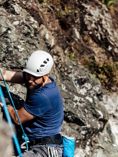
The trail the title promised. Hell Brook is the shortest, steepest, and most technical route up Mt. Mansfield, about 4.2 miles round trip and 2,600 feet of gain, most of it packed into a mile and a half that climbs at close to 45 degrees. There is hand-over-hand scrambling on slick rock slabs, roots, and ledges, with fixed metal bars bolted in where the rock alone won't do, leading up past Lake of the Clouds to the Chin. It is often wet, which turns hard into dangerous, and most hikers who go up it come down an easier way rather than reverse the scramble. This is for confident, fit hikers only, on a dry forecast, in real boots. The trailhead sits at the top of the Notch on Route 108, tow-vehicle-only and open only in season. Respect it and it is the most memorable few hours in the valley; underestimate it and it lives up to the name.
What to Pack for a Stowe Day Hike
Vermont summer hiking is friendlier than the elevation numbers suggest, but the mountains punish a few specific oversights. Footwear does the most work: the scrambles at Bingham Falls, Sterling Pond, and Hell Brook are all slick granite, and a trail shoe with real tread is the difference between a good day and a bad fall. Carry more water than the mileage implies, because the strenuous climbs are short but relentless.
A few pieces that pull their weight in a Stowe daypack:
- Bone-conduction headphones that leave your ears open to the trail let you have your music or a podcast on the long approaches while still hearing a bike coming at Cady Hill or a group descending above you.
- A quick-dry travel towel that clips to a pack and packs down to nothing is what turns the shore of Sterling Pond or an afternoon on the reservoir from a look-only stop into a swim.
- Compact high-power binoculars for reading the ridgeline from a summit earn their space on Mount Hunger and the Mansfield ridge, where half the fun is picking out the next peak over.
- A high-capacity power bank that keeps a phone alive through a full trail day matters because your phone is your map, and the lower Notch trails have thin coverage right where you need the GPS.
- Recovery sandals for the drive back to camp are a small mercy after a Hell Brook or Long Trail day, when your feet have opinions about staying in boots one minute longer.
For the broader kit, our roundup of camping and RVing gear every RVer actually needs sorts what lives in the RV from what rides in the pack. One thing that is not gear: these trails stay beautiful because hikers treat them well. Pack out everything, keep off the fragile alpine plants on the Mansfield summit, and leash dogs where posted. When kids are along, those habits set in early, which is a project of its own that we cover in raising kids who follow Leave No Trace without the nagging.
How to Spread These Trails Across a Week
The mistake is stacking the hard hikes back to back until the whole group is limping by Thursday. Open with an easy walk on an arrival or travel-tired morning, the rec path or Moss Glen Falls, then save a Stowe Pinnacle or a Mount Hunger for a day with fresh legs and a clean forecast. Slot Hell Brook or the Long Trail only when the rock is dry and nobody is already worn down, and build a recovery day around the walk down to Bingham Falls or a float on the reservoir in between. Reading the weather and the group each morning, rather than forcing the plan, is what keeps a hiking week feeling like a vacation.
Basing out of one campsite is what makes this rhythm possible; you pick the trail over breakfast instead of packing up and chasing trailheads across the state. It is the same play that carries our Watkins Glen RV itinerary through a very different gorge a few hours west, and it pairs naturally with the broader habit of staying active anywhere you park. Set up once, let the radius do the work, and Stowe hands you a hike for every kind of day you feel like having.
FAQs
What is the best easy hike in Stowe, Vermont?
Moss Glen Falls is the best easy hike in Stowe for scenery per step: a mostly flat walk of about a quarter mile from the trailhead off Randolph Road to a tall cascade in a rock amphitheater. For a view rather than a waterfall, Sunset Rock climbs about 1.1 miles round trip straight out of the village to a ledge over the valley, and the Stowe Recreation Path offers a flat, paved 5.3-mile greenway you can sample a mile at a time. All three suit mixed ages and require no special gear.
How hard is the Hell Brook Trail on Mt. Mansfield?
Hell Brook is the hardest maintained route up Mt. Mansfield and one of the steepest trails in Vermont. It runs about 4.2 miles round trip with roughly 2,600 feet of elevation gain, most of it in the first mile and a half at grades near 45 degrees. Expect hand-over-hand scrambling on slick rock slabs, roots, and ledges, with fixed metal bars bolted in on the hardest sections. It is for fit, experienced hikers on a dry day only, and most people descend by an easier route rather than reverse the climb.
Can you drive an RV to the Stowe hiking trailheads?
No, you should drive the tow vehicle, not the RV, to the trailheads, and some trailheads are off-limits to large vehicles entirely. Bingham Falls, Sterling Pond, Hell Brook, and the Long Trail summit route all sit on Route 108 through Smugglers' Notch, which bans single vehicles over 40 feet and vehicle-and-trailer combinations over 45 feet and closes from mid-October to mid-May. Leave the RV level at camp and use the tow vehicle for every trailhead, since trailhead parking is small roadside pull-offs that fill early on summer weekends.
What is the easiest way to the top of Mt. Mansfield?
The easiest way onto Vermont's highest summit is the Auto Toll Road, a 4.5-mile gravel road that carries a passenger vehicle from the Stowe Mountain Resort base to a parking area near the Nose. From there, a rocky ridge trail runs roughly 1.4 miles each way to the true summit, the Chin at 4,393 feet, along exposed alpine terrain that still requires sure footing and a weather check. It delivers the same summit view as the strenuous Long Trail and Hell Brook routes without the 2,800-foot climb, which makes it the pick for mixed-ability groups.
What is the best hike near Stowe with a big view for the effort?
Stowe Pinnacle offers the best view for the effort near Stowe: about 2.8 miles round trip with roughly 1,500 feet of climbing to a rocky knob with a panorama of Mt. Mansfield, Camel's Hump, the Worcester Range, and the Waterbury Reservoir. It is a steep, honest climb through hardwoods but a manageable morning rather than an all-day summit. For a longer strenuous option with an even wider view, Mount Hunger in Waterbury is about 4 miles round trip to a bare quartzite summit.
When is the best time to hike in Stowe?
Mid-June through August is peak hiking season in Stowe, with all trails open and the swimming holes worth the detour on hot days. Route 108 through Smugglers' Notch, which accesses several trailheads, is only open from roughly mid-May to mid-October, so the Sterling Pond, Hell Brook, Bingham Falls, and Long Trail routes are seasonal. Late September brings foliage and thinner crowds on weekdays. Start early any time of year to secure the small trailhead lots and to be off exposed summits before afternoon thunderstorms build.
Are there family-friendly hikes in Stowe for kids?
Yes. The Stowe Recreation Path is flat, paved, and stroller-friendly for its full 5.3 miles, and Moss Glen Falls is a short walk to a dramatic waterfall that holds kids' attention. Cady Hill Forest's trail network lets families pick a short loop while stronger hikers go longer from the same lot. Sunset Rock is a manageable 1.1-mile climb to a real view for older kids. Save the steep summits and the Route 108 scrambles for trail-tested older children.


Categories
Related Posts

Subscribe to the Swervia Newsletter
The best RV stories, tips, and destinations—expertly curated and always free.